As genealogists, we always want to know more. More about our ancestors, their back stories and where they came from. In my quest to understand the place Owasco, I stumbled upon the fact this little hamlet located on the eastern shore of modern day Crescent Lake, briefly had its very own post office from 1878-1879.1

I wondered if I could learn more about this post office. My 3x great-grandfather lived in Owasco and owned 640 acres. His orange groves were named Owasco and it was my understanding they were the only family living in Owasco. However, it appears that is not the case.
According to the National Archives collection “P.O. Reports of Site Locations, 1837 – 1950,” the Post Office Department did not have an official map maker before 1837. The first topographer was appointed and created maps for official postal use. Later, these maps were prepared as a comprehensive set for sale to the public.
These records determined the post office location in relationship to nearby post offices, transportation routes and facilities. They also include when the post office site would change, or the name of the location changed.
Over time, the forms changed to include more information such as:
- County and state;
- Land description, including range, township and section;
- Mail route number;
- Distance to nearest mail route;
- Closest rivers, creeks, canals, roads and railroads;
- Diagram or sketch of location;
- Contractor for the mail route;
- Number of families in the area;
- Number of people served by post office.
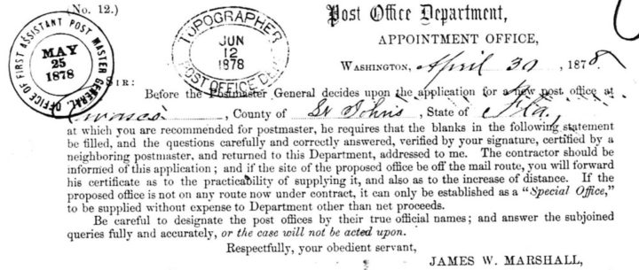
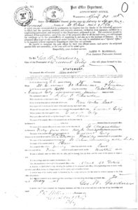
On the 30th of April 1878, the Post Office Department Appointment Office received an application for a new post office, located at Owasco in St. Johns County, Florida.2 The applicant was the first (and only) post master for this post office, George E. Gardner, who would receive the mail from Crescent City.3
What makes this a valuable source is the location information within the application. It details the plat map location, the distance from Crescent City to Owasco and the distance between Owasco and the nearest post office on the other side (St. Augustine, 45 miles away). It also details the most direct road, nearest creek and even the closest railroad.
The most important detail in this application is the population to be supplied by proposed office – About 30 voters. Beyond census information for the area, we know this post office would serve roughly 30 voters. Upon analyzing the 1880 US census, District 7 of St Johns County encompassed roughly 30 men eligible to vote.4
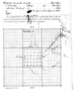
The second page of the application includes a map detailing the approximate locations of Palatka, Crescent City and Owasco. It also includes the geographical features of Dunns Lake and Haw Creek. Curiously, it includes two roads that no longer exist in a modern form: Augustine Road and Masters Road.
My next stop in learning more about Owasco and the roll it played in the area will be finding maps that include roads. Perhaps a map of the local mail routes still exist, and will include Owasco.
Record for Owasco, Florida, Postmaster Appointments for St Johns County, Florida, 29 May 1878 – 30 Oct 1879; Records of the Post Office Department, 1773 – 1971, Record Group 28; (Washington, D.C.: National Archives and Records Administration, 2010); digital image, The National Archives (https://catalog.archives.gov/id/78732504 : 18 May 2020). ↩
Record for Owasco, Florida; Post Office Department Reports of Site Locations, 1937 – 1950; Record Group 26, Roll 98; (Washington, D.C.: National Archives and Records Administration, 2010); microfilm, The National Archives (https://catalog.archives.gov/id/68267990 : 18 May 2020). ↩
Negative search results for additional post office applications. ↩
1880 U.S. Census, St Johns County, Florida, population schedule, Precinct 7, pgs. 9-11 (written); digital images, Ancestry (https://www.ancestry.com : accessed 4 Mar 2018); citing NARA microfilm publication T9, roll 132. ↩


Recent Comments